Headline News Archive
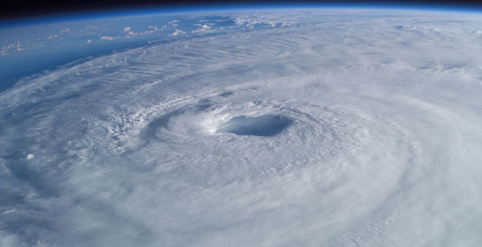 September 16, 2014 - A new study by Florida State University researchers demonstrates a different way of projecting a hurricane’s strength and intensity that could give the public a better idea of a storm’s potential for destruction.
 Vasu Misra, associate professor of meteorology and co-director of the Florida Climate Institute, and fourth-year doctoral student Michael Kozar introduce in the Monthly Weather Review of the American Meteorological Society a new statistical model that complements hurricane forecasting by showing the size of storms, not just the wind speed.
The model predicts the amount of integrated kinetic energy within Atlantic tropical cyclones. This kinetic energy metric is related to the overall size and strength of a storm, not just the maximum wind speed. Predictions of this metric complement existing forecasting tools, potentially allowing forecasters to better assess the risk of hurricanes that make landfall.
FSU Press Release:
http://news.fsu.edu/More-FSU-News/Research-offers-new-way-to-predict-hurricane-strength-destruction
http://news.fsu.edu/More-FSU-News/Research-offers-new-way-to-predict-hurricane-strength-destruction
Monthly Weather Review Article:
http://journals.ametsoc.org/doi/abs/10.1175/MWR-D-14-00117.1
http://journals.ametsoc.org/doi/abs/10.1175/MWR-D-14-00117.1
 September 4, 2014 - The FCI is pleased to welcome Florida A&M University in Tallahassee as its 8th member university! Dr. Odemari Mbuya is the branch director and Dr. Daniel Solis is the branch co-director. Both are from FAMU's College of Agriculture and Food Sciences.
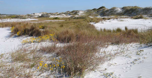 September 2, 2014 - This report was led by the FCI's Dr. Reed Noss and funded by the Kresge Foundation and the Florida Fish and Wildlife Conservation Commission. The study focuses on vulnerability of species and natural communities to interacting threats from sea level rise and projected land-use change (primarily urbanization), with some attention also to temperature and precipitation change. A range of adaptation options was analyzed for ca. 300 species and 30 natural communities of conservation concern.
Download the report:
http://floridaclimateinstitute.org/images/reports/201409NossKresge.pdf
http://floridaclimateinstitute.org/images/reports/201409NossKresge.pdf
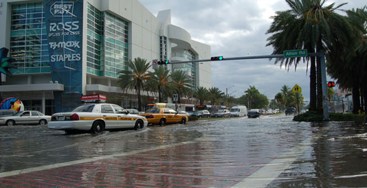 August 29, 2014 - Thanks to co-authors Alicia Betancourt and Maia McGuire, along with contributors Libby Carnahan, JP Gellermann and Mary Campbell, the Sustainable FloridiansSM program has a new module. The module, Climate Change and Sea Level Rise, was reviewed by Libby Carnahan and Gary Mitchum (USF) and consists of a PowerPoint presentation, a pdf of the PowerPoint presentation including the notes, lesson plan/facilitator outline, evaluation and post-test, action plan, and resources list.
 A pdf of the PowerPoint is available at:
http://buildgreen.ufl.edu/Extension_and_Sustainability/SF_Climate_Change_and_Sea_Level_Rise_public.pdf
http://buildgreen.ufl.edu/Extension_and_Sustainability/SF_Climate_Change_and_Sea_Level_Rise_public.pdf
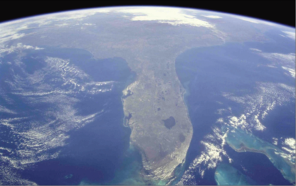 August 29, 2014 - The Florida Climate Institute has developed the Florida CARES center request that will bring together prominent universities across the State in partnership with state and regional agencies and the business community to create an economy more resilient to risks from hurricane damage, periodic droughts and floods, higher sea levels, and future climate trends. It will develop research and deliver education programs in support of Florida’s major economic engines (e.g., tourism, agriculture, trade, transportation and coastal marine resources). Working with partners from industries and agencies, it will help develop the workforce to manage Florida’s resources while growing its economy. Florida CARES will make Florida more competitive through its collaborative research and training programs, and create marketable expertise and technologies to meet the increasing demands of the state’s future.
See full proposal/request here:
http://floridaclimateinstitute.org/images/document_library/publications/201408LBRStrategyDocument.pdf
http://floridaclimateinstitute.org/images/document_library/publications/201408LBRStrategyDocument.pdf
 August 14, 2014 - To continue momentum under the Climate Data Initiative, the Obama Administration is renewing the President’s call to America’s private-sector innovators to leverage open government data and other resources to build tools that will make the U.S. and global food systems more resilient against the impacts of climate change. In response to this call, today’s launch includes a number of commitments by Federal agencies and private-sector collaborators to combat climate change and support food resilience through data-driven innovation.
 The Agricultural Model Intercomparison & Improvement Program and the Center for Integrated Modeling of Sustainable Agriculture and Nutrition Security. The Agricultural Model Intercomparison & Improvement Program (AgMIP) and the Center for Integrated Modeling of Sustainable Agriculture and Nutrition Security (CIMSANS), in partnership with the International Food Policy Research Institute (IFPRI), are announcing a new public-private partnership on open data and open-source code modeling to enhance the climate-resilience of food systems. The new partnership will secure the resources and expertise necessary to evaluate seven novel nutrition and sustainability metrics of global food systems, including all of the world’s important staple and non-staple foods, through the year 2050.
Monsanto. Monsanto is announcing that it will donate a multi-site/multi-year maize breeding trial dataset to open data portals maintained by the International Center for Tropical Agriculture (CIAT) and the Agricultural Model Intercomparison & Improvement Project (AgMIP). Opening these data will it make it possible for public- and private-sector scientists to improve models being used to understand how climate and water-availability changes will impact crop productivity and therefore food security. Monsanto is also partnering with a number of external scientists in the AgMIP community to improve one of the leading publicly available crop-growth simulation models (AgMaize).
Fact Sheet: http://www.whitehouse.gov/the-press-office/2014/07/29/fact-sheet-empowering-america-s-agricultural-sector-and-strengthening-fo
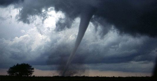 August 6, 2014 - New research by a Florida State University geography professor shows that climate change may be playing a key role in the strength and frequency of tornadoes hitting the United States.
 Published Wednesday in the journal Climate Dynamics, Professor James Elsner writes that though tornadoes are forming fewer days per year, they are forming at a greater density and strength than ever before. So, for example, instead of one or two forming on a given day in an area, there might be three or four occurring.
FSU Press Release: http://news.fsu.edu/More-FSU-News/New-research-links-tornado-strength-frequency-to-climate-change
Climate Dynamics Article: http://link.springer.com/article/10.1007%2Fs00382-014-2277-3
Climate Dynamics Article: http://link.springer.com/article/10.1007%2Fs00382-014-2277-3
 July 8, 2014 - Drs. Mark Powell (NOAA/FSU) and Steve Cocke (FSU) are part of a new collaboration between NOAA and the Dept. of Energy to collect data that could lead to improved offshore wind turbine designs. Powell's efforts will involve boundary layer research, and Cocke will work on hurricane risk modelling.
  June 26, 2014 - At the latest in a series of workshops known as InTeGrate: Teaching about Risk and Resilience, educators and managers learned about transferring actionable knowledge on climate change and disaster preparedness to relevant sectors, including policy-makers and the general public.
 InTeGrate, a project funded by the National Science Foundation, brought sixty professionals, including scientists and researchers, to the Florida Atlantic University (FAU) campus in Boca Raton, Florida on May 14-16, 2014. A central question in the series is, “How do we prepare students for careers where they can make useful and valuable contributions that mitigate risks and increase resilience in the face of a growing population and changing environment?” The interdisciplinary project was developed by Cathy Manduca, Director of the Science Education Resource Center (SERC) at Carleton College and David Blockstein, National Council for Science and the Environment. For the May workshop Leonard Berry, Director of the Florida Center for Environmental Studies (CES) at FAU, Mantha Mehallis at FAU’s College of Business and John Taberof IRIS (Incorporated Research Institutions for Seismology) joined the team to develop the workshop topic of Risk and Resilience.
In his opening keynote address, Berry set the stage by summarizing the key concepts of risk and resilience. He spoke about the work required of the community in sharing risk and the effective collaboration demonstrated by the Four County Climate Change Compact in South Florida. He advocated using an interdisciplinary approach and the realities of climate change politics. He also posed a question, “Does resilience need to increase as risk increases?”
In response, Ricardo A. Alvarez, former Deputy Director, International Hurricane Center, Research Affiliate at CES, spoke about the challenges of interpreting science to vulnerable communities. After extolling the use of real life case studies in teaching about risk and resilience, he and Nancy Gassman, Assistant Director of Public Works Sustainability, City of Fort Lauderdale, presented a sea level rise scenario from South Florida, while Mark Benthien of University of Southern California (USC) and Keith Porter of SPA Risk LLC presented an earthquake scenario from California.
Panel discussions led to breakout discussions related to flooding, coastal erosion, water-management, and seasonal, extreme high tides. For example, participants most interested in the Fort Lauderdale case study noted the indirect impact of Hurricane Sandy exacerbated by sea level rise. The session, moderated by Eileen Johnson of Bowdoin College, examined the scientific and engineering aspect of the study, and addressed teaching the subject matter to undergraduates.
Rounding out the team of workshop presenters and conveners, Monica Bruckner of SERC at Carleton College and Mary Beth Hartman of CES at FAU coordinated and hosted the event.
For more information on climate change research and education at FAU’s Center for Environmental studies, please visit http://www.ces.fau.edu
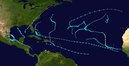 May 30, 2014 - Scientists at Florida State University’s Center for Ocean-Atmospheric Prediction Studies (COAPS) believe this year’s hurricane season, starting June 1, will be a quiet one. In the center’s sixth annual Atlantic hurricane forecast, FSU scientists predict that there is a 70 percent chance of five to nine named storms this year and two to six hurricanes. The average is seven named storms, four of them hurricanes, and an average accumulated cyclone energy (a measure of the strength and duration of storms accumulated during the season) of 60. The primary reason for the below normal numbers, said lead scientist Timothy LaRow, is that an El Niño — or warmer than normal water temperatures — is forecast to develop in the tropical Pacific. “El Niño develops when sea surface temperatures in the eastern equatorial Pacific Ocean are warmer than normal for several consecutive months, leading to increased vertical wind shear in the Atlantic, which can disrupt developing tropical systems,” LaRow said. “How quickly and how intense the El Niño becomes will determine its impact on the North Atlantic hurricane season.” The 2014 North Atlantic hurricane forecast numbers are based on 60 individual seasonal atmospheric forecasts conducted at FSU on its High Performance Computing Cluster using sea surface temperatures predicted by the National Oceanic and Atmospheric Administration (NOAA) climate model. LaRow’s forecast is developed using a unique atmospheric model created at FSU that has had remarkable success in predicting seasonal tropical activity. Since 1995, when the North Atlantic entered the period of heightened activity, the model has predicted 14.1 named storms and 7.9 hurricanes per year compared to the observed 14.7 named storms and 7.7 hurricanes. The model is one of only a handful of climate models being used to study seasonal hurricane activity. Hurricane season begins June 1 and runs through Nov. 30.
 FSU COAPS Hurricane Forecast Webpage: http://coaps.fsu.edu/hurricanes
FSU Press Release: http://news.fsu.edu/More-FSU-News/2014-hurricane-forecast-predicts-below-average-season-ahead
 May 30, 2014 - Florida Atlantic University (FAU) continues studying the effects of sea level rise in South Florida with a new focus on climate change related health risks. The Florida Public Health Institute (FPHI) serves as the lead on the project, made possible by a $250,000 grant from the Kresge Foundation over a two year period. Project Lead Dr. Leonard Berry, Director of the Center for Environmental Studies at FAU (CES), said the project provides CES the opportunity to expand its area of study. “Of all the potential impacts of sea-level rise, health may be one of the least studied and yet is one of the most important. This grant will enable us to begin to redress this imbalance.”
According to FHIP, potential health risks include water quality changes such as saltwater intrusion, landfill/brownfield seepage, higher levels of sewage and toxic pollutants, increasing rates of waterborne diseases, and higher rates of respiratory-related illness due to increasing levels of airborne allergens such as mold exposure.
The project resulted from four years of collaboration between Debora Kerr (FPHI Chief Operating Officer) and Nicole Hernandez Hammer, Co-Principal Investigator (FAU). Researchers will map storm-related health data across time and geography in Palm Beach, Broward, Miami-Dade and Monroe C ounties. Hammer and Co-Principal Investigators from FAU, Drs. Frederick Bloetscher and Diana Mitsova, will be overlaying health data onto FAU-developed groundwater maps. The funding represents one of the many outcomes of the October 2013 Sea Level Rise Summit hosted by FAU.
Contributing to the health data collection are Kristina Kitzinger and Meredith Jagger, leads on the Florida BRACE Project, one of fourteen national initiatives of the Centers for Disease Control and Prevention in Building Resilience Against Climate Effects initiatives.
For more information on climate change research and education at FAU’s Center for Environmental studies, please visit http://www.ces.fau.edu.
 May 30, 2014 - Dr. Kathleen Ruppert received the University of Florida’s Champion of Change award in the academics category through the Office of Sustainability and Healthy Gators for her work in developing an Action Plan for promoting sustainability in extension offices. Many Extension offices are being asked to save money for their county in any way possible. The University of Florida (UF) Institute of Food and Agricultural Sciences Program for Resource Efficient Communities, working with UF's Office of Sustainability and undergraduate students in UF's College of Design, Construction and Planning, produced the document, Action Plan for Promoting Sustainability in Extension Offices. The intent is to help Extension offices become models for resource-efficient, sustainable, behavior for the clients and community they serve as well as saving money for the county. Note that the Excel spreadsheet, found at http://buildgreen.ufl.edu/Extension_and_Sustainability.htm, is referenced in the Word document also found on the same website. The students who worked on this document hope that a few faculty, staff members, and volunteers working within each county Extension office will take on this challenge to create and promote a greener and more sustainable world. Both the Word document and the Excel spreadsheet are intended to be copied to your hard drive and edited to fit the needs of individual county Extension offices. Note that, with some minor changes, these materials could be utilized by any group or organization. Please consider the students’ request and show that all organizations are interested in initiating practices that contribute to a more sustainable, high quality of life in and for all communities. If you have questions or suggestions for improving the document or spreadsheet, contact Kathleen Ruppert (This email address is being protected from spambots. You need JavaScript enabled to view it.) with the Sustainable FloridiansSM program.
Kathleen Ruppert has devoted her professional career to educating, inspiring, and empowering students to become changemakers in the world. She has portrayed tremendous dedication within the area of sustainable education by encouraging real-world sustainability projects through teaching a capstone course and by helping to extend both the UF Prairie Project and the Sustainable Floridians program.
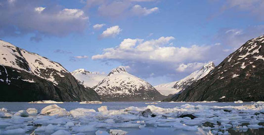 May 29, 2014 - Yesterday, the U.S. Environmental Protection Agency (EPA) released the third edition of a report, Climate Change Indicators in the United States. The report pulls together observed data on key measures of our environment, including U.S. and global temperature and precipitation, ocean heat and ocean acidity, sea level, length of growing season, and many others. With 30 indicators that include over 80 maps and graphs showing long-term trends, the report demonstrates that climate change is already affecting our environment and our society.
 EPA Press Release: http://yosemite.epa.gov/opa/admpress.nsf/0/461768B5CE68DC8B85257CE600558D63
Report: http://www.epa.gov/climatechange/science/indicators/index.html
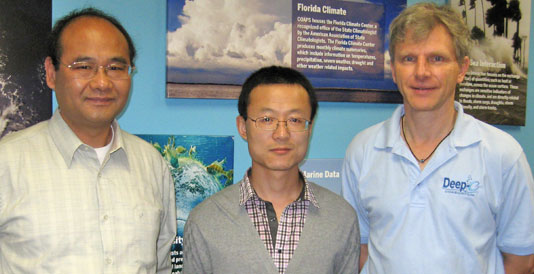 May 5, 2014 - New research by a team of Florida State University scientists shows the first detailed look at global land surface warming trends over the last 100 years, illustrating precisely when and where different areas of the world started to warm up or cool down. The research indicates that the world is indeed getting warmer, but historical records show that it hasn’t happened everywhere at the same rate.
 “Global warming was not as understood as we thought,” said Zhaohua Wu, an assistant professor of meteorology at FSU. Wu led a team of climate researchers including Fei Ji, a visiting doctoral student at FSU’s Center for Ocean-Atmospheric Prediction Studies (COAPS); Eric Chassignet, director of COAPS; and Jianping Huang, dean of the College of Atmospheric Sciences at Lanzhou University in China. The group, using an analysis method newly developed by Wu and his colleagues, examined land surface temperature trends from 1900 onward for the entire globe, minus Antarctica. Previous work by scientists on global warming could not provide information of non-uniform warming in space and time due to limitations of previous analysis methods in climate research.
The research team found that noticeable warming first started around the regions circling the Arctic and subtropical regions in both hemispheres. But the largest accumulated warming to date is actually at the northern midlatitudes. They also found that in some areas of the world, cooling had actually occurred. “The global warming is not uniform,” Chassignet said. “You have areas that have cooled and areas that have warmed.” For example, from about 1910 to 1980, while the rest of the world was warming up, some areas south of the equator — near the Andes — were actually cooling down, and then had no change at all until the mid 1990s. Other areas near and south of the equator didn’t see significant changes comparable to the rest of the world at all.
FSU Press Release: http://news.fsu.edu/More-FSU-News/New-study-sheds-light-on-global-warming-trends
Nature Climate Change Article: http://dx.doi.org/10.1038/nclimate2223
FSU Press Release: http://news.fsu.edu/More-FSU-News/New-study-sheds-light-on-global-warming-trends
Nature Climate Change Article: http://dx.doi.org/10.1038/nclimate2223
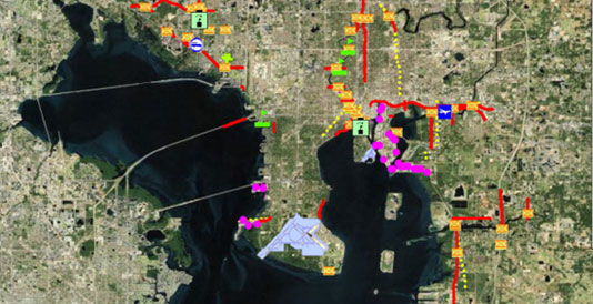 April 30, 2014 - A visualization tool has been developed by the University of Florida Urban and Regional Planning research team directed by Dr. Zhong-Ren Peng as part of the Mississippi-Alabama Sea Grant Consortium project “Development of Sea Level Rise Adaptation Planning Procedures and Tools Using NOAA Sea Level Rise Impacts Viewer.” The tool helps local planners identify the most vulnerable infrastructures and places using the inundation data provided by the NOAA Sea Level Rise and Coastal Flooding Impacts Viewer. Using the online visualization tool (University of Florida sea level rise viewer), the users can easily view the estimated vulnerability under 1-foot, 2-foot, and 5-foot scenarios. Detailed information regarding the vulnerable infrastructure and the vulnerable census block groups can also be viewed.
 The tool is available at http://plaza.ufl.edu/dengyujun11/SLR7.0.html. More information regarding the viewer could be found at NOAA’s website http://csc.noaa.gov/digitalcoast/stories/tampa-viewer.
April 25, 2014 - On April 24th, Climate Central released an enhanced version of its Surging Seas Risk Finder for Florida. The Risk Finder is a public web tool that provides local projections, maps and assessments of exposure to sea level rise and coastal flooding tabulated for every zip code and municipality along with planning, legislative and other districts. Exposure assessments cover over 100 demographic, economic, infrastructure and environmental variables using data drawn mainly from federal sources, including NOAA, USGS, FEMA, DOT, DOE, DOI, EPA, FCC and the Census. The web tool was recently highlighted at the launch of The White House's Climate Data Initiative.
New features include:
New features include:
- downloadable data - including detailed projections, place summary tables, and low-lying facility lists
- improved map: includes property value layer
- more forecasts: including the latest IPCC projections
- more variables analyzed: military areas, parks, protected land, colleges & universities,
- more more places analyzed: FL county commission districts, FL city council and commission districts, state legislative districts and more
- dynamic threat rankings (by variable and water level)
- tablet-friendly layout
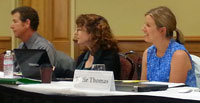 April 24, 2014 - On April 22-23, the Florida State University Department of Earth, Ocean and Atmospheric Science hosted the National Academy of Sciences (NAS) Board on Atmospheric Sciences and Climate (BASC) spring meeting. This meeting was part of the board’s efforts to connect more directly with atmospheric sciences and climate researchers and users of our science outside the beltway. The board was excited to hear about new research that faculty and students at FSU are pursuing, to learn more about challenges the region faces, especially on climate preparedness and weather extremes, and to consider how regional issues and approaches related to federal priorities and initiatives. The co-directors of the FSU branch of the FCI, Drs. Eric Chassignet and Vasu Misra, both gave presentations that included FCI research.
BASC is the focal point within the National Academy of Sciences for activities related to the atmospheric and climate sciences, serving as a source for objective, independent advice to the federal government and others. Through its board meetings, study committees, and convening functions, BASC strives to advance understanding of atmospheric science, meteorology, and climate; foster application of this knowledge to benefit the public; guide US research programs so they address key scientific opportunities and the needs of the nation; and ensure that the voice of the science community is considered in government planning and decision making.
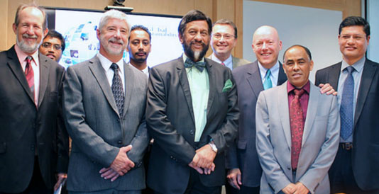 April 24, 2014 - On April 24, 2014, Dr. Rajendra Pachauri, Chair of the Intergovernmental Panel on Climate Change (IPCC) became the first recipient of the University of South Florida's Patel College “Eminent Global Scholar in Sustainability Award” in recognition of his extraordinary accomplishments in advancing the science and understanding of climate change and international policy. Dr. Pachauri’s visit to the USF Patel College comes on the heels of the recent Climate Change report released earlier this month by the U.N. IPCC that identified a clear human influence on the climate system. His compelling lecture to USF faculty, staff and students on “Energy Scenarios and Climate Impacts” was followed by a vibrant question and answer session.
  April 23, 2014 - The U.S. Environmental Protection Agency (EPA) today announced the four winners of its second annual Campus RainWorks Challenge, a design challenge created to engage college and university students in reinventing our water infrastructure and developing innovative green infrastructure systems to reduce stormwater pollution and build resilience to climate change.
The University of Florida won 1st Place in the Master Plan Category for a design addressing a 67.6 acre subwatershed in the northeast corner of campus. To engage students with the journey of water, the three-phase plan would transform two detention facilities into campus amenities and daylight the flow of stormwater into above ground pipes and vegetated bioswales. In addition to treating and retaining stormwater and improving groundwater recharge, the team’s plan would improve aesthetics and safety along a major road.


