Headline News Archive
 January 16, 2015 - Do you know why El Niño forecasts are so important? Robert O. Lawton Distinguished Professor James O’Brien, the guy that former Florida State University President Bernie Sliger referred to as “Dr. El Niño,” sure does. El Niño is defined by prolonged warming of sea surface temperatures in the Pacific Ocean. But researchers, including O’Brien, found over the years that those conditions often concoct the perfect storm of conditions for hurricanes and tornadoes. In the mid 1980s, he was one of three scientists recruited by the National Oceanic and Atmospheric Administration to build models to predict when we were about to experience the weather phenomenon. And when most of his colleagues began looking at how that weather pattern affected South America and Asia, he turned his attention to the United States, churning out predictions of how many hurricanes and tornadoes the country might experience. “I started out as an ocean modeler, putting math in the computer and then participating in building early prediction models,” he said.
 Because of his contributions to this field, O’Brien is being recognized as a fellow of the International Union of Geodesy and Geophysics, a global organization dedicated to advancing research of the Earth and its environment. Franz Kuglitsch, executive secretary for the organization, said O’Brien received the honor for his exceptional contributions to “international cooperation in geoscience” and for having “attained eminence in the field of Earth and space sciences.” O’Brien, an accomplished meteorologist, has worked at Florida State for more than 40 years. “I was honored and surprised by the award,” O’Brien said. O’Brien, who received his bachelor’s degree from Rutgers University and his doctoral degree from Texas A&M University, is the retired director of the Center for Ocean-Atmospheric Prediction Studies (COAPS). He retired as the center’s director in 2006, but remains actively involved in the university and in his field as a professor emeritus. Eric Chassignet, O’Brien’s successor at the COAPS, called his colleague a “dynamic force.” “His work on coastal upwelling, El Niño/La Niña, and climate variability have made lasting contributions,” Chassignet said. “Not only is he known for his scientific work and his service to the community — he also has an impressive record of student mentorship. In recent years, he has worked to ensure that the next generation of scientists has the full set of skills necessary to move forward in their careers. It was his vision and relentless energy that led to the creation of COAPS, and we are grateful that even in retirement he continues to give his time and expertise to our center.”
O’Brien will be presented with the award in July in Prague.
FSU Press Release: http://news.fsu.edu/More-FSU-News/James-O-Brien-AKA-Dr.-El-Nino-Named-Fellow-of-International-Research-Group
 January 13, 2015 - For every degree Celsius that the temperature increases, the world stands to lose 6 percent of its wheat crop, according to a new global study led by a University of Florida scientist. That’s one fourth of the annual global wheat trade, which reached 147 million tons in 2013.
 Senthold Asseng, a UF professor of agricultural and biological engineering, used a computer model approach to reach the finding of temperature increases and wheat production.
“We started this with wheat, as wheat is one of the world’s most important food crops,” said Asseng, whose team’s study was published online Dec. 22 in the journal Nature Climate Change. “The simulations with the multi-crop models showed that warming is already slowing yield gains, despite observed yield increases in the past, at a majority of wheat-growing locations across the globe.”
University of Florida Press Release: http://news.ufl.edu/archive/2015/01/ufifas-study-wheat-yield-to-decline-as-temperatures-increase--.html
Nature Climate Change Article: http://dx.doi.org/10.1038/nclimate2470
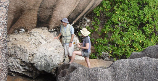 January 12, 2015 - The balmy islands of Seychelles couldn’t feel farther from Antarctica, but their fossil corals could reveal much about the fate of polar ice sheets.
 About 125,000 years ago, the average global temperature was only slightly warmer, but sea levels rose high enough to submerge the locations of many of today’s coastal cities. Understanding what caused seas to rise then could shed light on how to protect those cities today.
By examining fossil corals found on the Indian Ocean islands, University of Florida geochemist Andrea Dutton found evidence that global mean sea level during that period peaked at 20 to 30 feet above current levels. Dutton’s team of international researchers concluded that rapid retreat of an unstable part of the Antarctic ice sheet was a major contributor to that sea-level rise.
University of Florida Press Release: http://news.ufl.edu/archive/2015/01/on-a-tropical-island-fossils-reveal-the-past--and-possible-future--of-polar-ice.html
Gainesville Sun Article: http://www.gainesville.com/article/20150112/ARTICLES/150119938
Quaternary Science Reviews Article: http://dx.doi.org/10.1016/j.quascirev.2014.10.025
 January 9, 2015 - On December 12, 2014, Dr. Leonard Berry was honored for his work in understanding climate change with the President’s Distinguished Service Medallion, awarded to individuals who have rendered service of great value to Florida Atlantic University (FAU) and the community at large, for example, US Senator Bill Nelson. Upon receiving the award, Dr. Berry said, “It was an acknowledgement at the university level of the importance of this topic.”
 A lead author of Chapter 17, Southeast and the Caribbean, of the National Climate Assessment, Dr. Berry has worked on climate change issues locally, nationally and globally for over 40 years. He is the founder and immediate past Director (1994-2014) of the Florida Center for Environmental Studies, Emeritus Professor of Geosciences and the Director of the Climate Change Initiative at FAU. He is also an Executive Committee member of The Florida Climate Institute (FCI). In April 2012, he testified to the United States Senate full committee on Natural Resources and Energy on the impacts of sea level rise in Florida.
He has worked on environmental research and development training programs for USAID, UNDP, UNESCO, GEF and UNEP, and the World Bank. He is a core member of the Inter-American Water Resources Network, The Southeast Florida Regional Climate Change Compact’s sea level rise technical working group, Florida Department of Economic Opportunity Community Resilience Group, Public Water Supply Utilities Climate Impacts Working Group, National Council for Science and the Environment, and the WaterWeb Consortium, an international water information group. Dr. Berry continues his work in climate change with FCI.
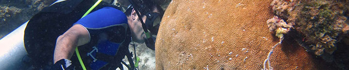
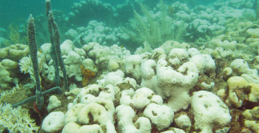
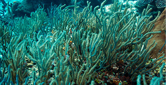 December 8, 2014 - A new study on tropical shallow-water soft corals, known as gorgonians, found that the species were able to calcify and grow under elevated carbon dioxide concentrations. These results suggest that Caribbean gorgonian corals may be more resilient to the ocean acidification levels projected by the end of the 21st century than previously thought.
 An international team of scientists, including from the University of Miami (UM) Rosenstiel School of Marine and Atmospheric Science (RSMAS), tested the effects of elevated CO2 concentrations on the growth and calcification rates of the sea rod, Eunicea fusca, a type of gorgonian or soft coral found throughout the Bahamas, Bermuda, South Florida and into the Gulf of Mexico. Researchers collected E. fusca specimens from Big Pine Shoals in the Florida Keys to simulate a range of predicted future ocean acidification conditions – CO2 concentrations from 285-2,568 parts per million (pH range 8.1-7.1) – during a four-week experiment at the UM Rosenstiel School’s Coral Reefs and Climate Change Laboratory. Eunicea fusca showed a negative response to calcification under elevated CO2 concentrations, but growth and calcification did not stop under any of the CO2 levels used in the study.
Full UM RSMAS Press Release and Video
Related Miami Herald Article
Photo Caption: Eunicea fusca, Curacao. Photo Credit: Juan A. Sanchez – Universidad de los Andes, Bogota Colombia
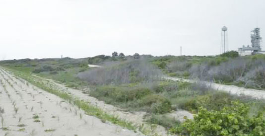 December 8, 2014 - The effects of climate change are already showing up in places from Miami to Alaska, scientists say, but two University of Florida geologists are focusing their attention on one especially noteworthy and vulnerable piece of waterfront real estate: Kennedy Space Center. What’s more, they say, the problem could affect operations at the space center within the next decade. “We were a little blind to it, like pre-Katrina New Orleans,” said one of the researchers, assistant professor Peter Adams of the UF Geological Sciences department. “Now that we’ve seen it, we’re sensitive to it.” Adams and associate professor of geology John Jaeger, who have been studying Cape Canaveral’s dunes and beach since 2009, say the impacts became most apparent after Hurricane Sandy. “Sandy got a lot of press up north, but it really did a tremendous amount of damage at Cape Canaveral,” Jaeger said. “Areas that had previously been relatively stable for decades … suddenly they were gone.” Adams said a combination of climate change-related sea-level rise and increased wave energy is almost certainly to blame.
Full UF Press Release and Video
December 4, 2014 - The US Department of Energy (DOE) on Tuesday recognized Broward County and the Southeast Florida Regional Climate Change Compact (“Compact”) as Climate Action Champions following a nationwide competition. Only sixteen cities, regions, and tribal governments across the county were selected as the first cohort of Climate Action Champions. Broward County and the partners in the 4-County Compact join Seattle, San Francisco, Portland (OR), Boston, Minneapolis, the DC metro area, and other climate-leader communities.
The designation honors the “decisive action to cut carbon pollution and build resilience” already undertaken by the four Compact counties—Broward, Palm Beach, Miami-Dade, and Monroe. Since its establishment in 2009, the Compact has produced a series of technical planning documents providing a common framework for planning, including a unified sea level rise projection; published a five-year Regional Climate Action Plan (RCAP) and undertaken significant efforts to implement its 110 recommendations; and held annual summits reaching hundreds of local and regional leaders.
Full Broward County Press Release: https://webapps.broward.org/newsrelease/AdminDisplayMessages.aspx?intMessageId=5727
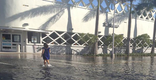 December 3, 2014 - Will vector-borne diseases such as Dengue Fever and West Nile Virus increase along with sea level rise? Florida Atlantic University (FAU) continues to support the Florida Institute for Health Innovation (FIHI, formerly FPHI) in its work studying climate change related health risks. The project has been made possible by a $250,000 grant from the Kresge Foundation to FIHI over a two year period ending in 2015. (See related article.)
FAU’s Department of Civil, Environmental, and Geomatics Engineering teamed with FAU’s School of Urban and Regional Planning to provide GIS data mapping and analysis. Combined with health data from the Florida Department of Health, researchers are seeking to identify populations in Southeastern Florida vulnerable to the effects of sea level rise and to determine if these populations will be at an increased risk for disease as sea levels rise. This phase of the project focuses on cryptosporidiosis, giardiasis, vector-borne diseases, vibriosis, and salmonellosis.
Project planning committee member Dr. Colin Polsky, Director of the Center for Environmental Studies at FAU (CES), said the project is in line with the Center’s vision of improving Florida's sustainability through research, education and outreach on ecology, climate change, and society: "The interdisciplinary nature of the project is the kind CES is designed to support. Targeted research in the health domain is particularly needed, and addressing this need puts CES on the cutting edge.”
For more information on climate change research and education at FAU’s Center for Environmental Studies, please visit www.ces.fau.edu.
Photo Caption: Lunar High Tide Flooding Miami Beach. Photo Credit: FAU CES.
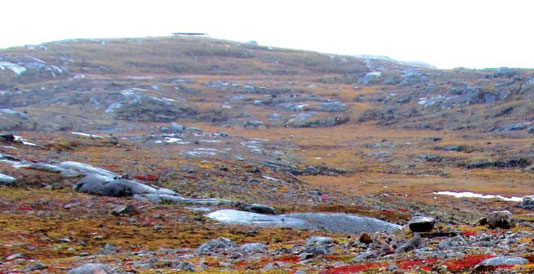 December 3, 2014 - Dr. Thomas Bianchi (UF), Dr. Mead Allison, and collaborators are developing a high-resolution record of the climate from the Holocene into the late Pleistocene in the Arctic, using sediment from the Beaufort Sea in Alaska. In a Q&A published in International Innovation, they jointly describe the reasons for studying the climate record in this region, and how the different members of their term converged to effectively do so.
 Access the article through Dr. Bianchi's website or the International Innovation website.
 November 19, 2014 - A new study by a Florida State University biologist shows that bleaching events brought on by rising sea temperatures are having a detrimental long-term impact on coral.
 Professor Don Levitan, chair of the Department of Biological Science, writes in the latest issue of Marine Ecology Progress Series that bleaching — a process where high water temperatures or UV light stresses the coral to the point where it loses its symbiotic algal partner that provides the coral with color — is also affecting the long-term fertility of the coral.
FSU Press Release: http://news.fsu.edu/More-FSU-News/Study-Environmental-bleaching-impairs-long-term-coral-reproduction
Journal Article: http://dx.doi.org/10.3354%2Fmeps11063
 October 31, 2014 - The Florida Climate Institute at UF has awarded its 2014-15 Faculty Fellows. Dr. Jane Southworth and Jonathan Dain received this year’s award for their superior contributions to the FCI and its programs on the UF campus and abroad. Both fellows receive a 3 year stipend in recognition of their efforts in climate research, education, and outreach. Dr. Jane Southworth is a Professor in the Department of Geography and Jonathan Dain is the Director of the Florida Natural Resources Leadership Institute and faculty in the Center for Latin American Studies. Congratulations to both on their well-deserved awards!
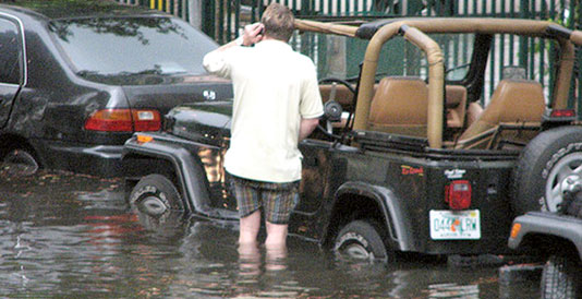 October 30, 2014 - Along South Florida’s coast a yearly event known as the King Tide has become an inconvenience to residents--the abnormally high tide pushes into sewage pipes and drowns roads in its path. The King Tide occurs when the sun and the moon are the closest to the earth. Over time the flooding has been getting more severe and has caused the local government millions of dollars in repairs. As a reprisal, local counties have implemented various methods to combat the flooding this year. Miami Beach has installed $15 million dollars’ worth of pumps to save the beachfront from excessive flooding, which is part of its five-year plan to protect the area from the consequences of sea level rise. The pumps have minimized the flooding to a more manageable amount; however, this temporary solution may not be the correct way to solve a progressing problem. A study done on tidal flooding using data collected for the White House’s National Climate Assessment illustrates how the flooding will increase over time, especially in Miami and Key West, due to sea level rise and the lack of preventative measures being taken.
 The highest peak of the tide was predicted to be on Wednesday, October 8th but due to rain and the aid from the pumps the highest was recorded on Tuesday, October 7th. In Fort Lauderdale, Broward County installed 44 special tidal valves that helped combat flooding. Since King Tide flooding is predicted to occur more frequently as sea level continues to rise, the question is, where are the long term solutions? Natural events like these represent a perfect opportunity for informing the public and government officials about the costs of sea level rise adaptation and mitigation.
Sources:
Photo caption/credit: The flood-prone streets of Miami. Photo credit: Maxstrz / Creative Commons
 October 30, 2014 - The Florida Center for Environmental Studies (CES) at FAU begins an exciting new chapter and welcomes a new Director, Dr. Colin Polsky. CES has updated their mission of improving Florida's sustainability through research, education and outreach on ecology, climate change, and society.
In August 2014, Dr. Polsky joined FAU as Professor of Geosciences and successor to Dr. Leonard Berry, who founded CES in 1994 and remains active as Emeritus Professor of Geosciences. Dr. Polsky joins Dr. Berry on the Executive Board of the Florida Climate Institute (FCI).
Dr. Polsky is trained as a geographer, specializing in the Human Dimensions of Global Environmental Change. His programs of study and postdoctoral work in mathematics, humanities, French, geography, and Science & International Affairs (from U. Texas, Penn State, and Harvard, respectively) have led to a sustained interest in advancing knowledge of U.S. climate vulnerabilities, in both methodological and applied terms.
In addition to multiple NSF grants, peer-reviewed articles and co-authored books, Polsky has served as co-Convening Lead Author for a chapter in the 2013 National Climate Assessment, served on NRC, NSF, and USGCRP committees, and prepared reviews for several IPCC reports.
His experience and strong sense of purpose for CES will lead the Center in further expanding its impact on sustainability in Florida. Contact him at
For more information on climate change research and education at FAU’s Center for Environmental studies, please visit http://www.ces.fau.edu
 October 30, 2014 - In 2011, the interagency group known as the Compact Sea Level Rise (SLR) Working Group, organized by the Southeast Florida Regional Climate Change Compact, came to an agreement on the projections for sea level rise that the Compact would use for sea level change up to the year 2060. In light of this year’s IPCC Report from NOAA, revised SLR Considerations from the U. S. Army Corps of Engineers, and the 2014 National Climate Assessment SLR projections, the Compact SLR Working Group is now meeting again to update the projections through 2100. Led by Dr. Samantha Danchuk, P.E., Assistant Director, Environmental Planning and Community Resilience Division, Broward County, group members include representatives from several South Florida universities and municipalities, and the South Florida Water Management District.
October 21, 2014 - The College of Agriculture and Food Sciences announces that Charles Magee, Ph.D., professor of Biological and Agricultural Systems Engineering (BASE), has received a four-year grant of $800,000 from the USDA Natural Resources Conservation Service (NRCS) to provide scholarships for students majoring in BASE. Starting October 1, 2014 through September 30, 2018, the BASE program will receive $200,000 per year in scholarship funds. Each year, 14-16 high school and college students will receive scholarships ranging from $8,000 to $16,000 dollars. This $800,000 scholarship award is believed to be the largest scholarship award any federal agency has given to a single academic program at FAMU.
Students interested in a BASE scholarship should contact Dr. Charles Magee atThis email address is being protected from spambots. You need JavaScript enabled to view it. or call (850) 412-5594.
Download Flyer
Students interested in a BASE scholarship should contact Dr. Charles Magee at
Download Flyer
 October 2, 2014 - Daniel Solís, Ph.D., Assistant Professor at FAMU’s College of Agriculture and Food receives the 2014 - 2015 FAMU’s Faculty Research Award for his research project: "The Effect of IFQs on the Total Productivity of the U.S. Gulf of Mexico Red Snapper Industry". With grant support from The National Oceanic and Atmospheric Administration, this Agribusiness Program professor, set a goal to analyze the impact of regulations and climate variability on the technical efficiency and composition of the Gulf of Mexico Red Snapper commercial fleet. For more details, please visit: http://dsolisw.weebly.com/
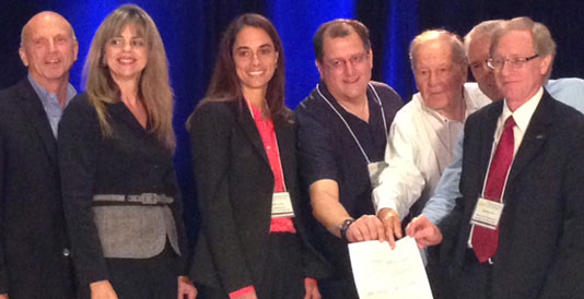 October 2, 2014 - A partnership between the Southeast Florida Regional Climate Change Compact (Compact) and the Florida Climate Institute (FCI) aims to increase the effectiveness of current collaborations among Florida’s institutions of higher learning and the local governments and regional agencies of Southeast Florida. The purpose of the Partnership Agreement, signed Wednesday, October 1 in Miami, is to seek better alignment between public sector information and management needs and ongoing research objectives, to improve coordination among the parties in pursuing competitive research funding opportunities, and to assure that the best and brightest ideas emerging from Florida’s world-class institutions are well positioned for implementation in supporting Southeast Florida’s efforts to adapt to climate change and sea level rise and transition to a more resilient economy and coastal infrastructure.
 Created in 2009 by forward-thinking elected officials, the Compact has emerged as one of the preeminent regional metropolitan climate change governance models nationally and globally. The collaboration and coordination across cities and counties and among federal, state, and local agencies has advanced the region rather quickly toward increased shared aspirations for greater climate resilience and reductions in regional emissions. Likewise, the Florida Climate Institute, created in 2010, is a path-breaking collaboration among eight of Florida’s world-class universities that serves as a multidisciplinary network for research and education aimed at helping Florida meet the many challenges of global climate change. Together, the Compact and FCI recognize that responsible action on global climate change will require the talents and insights of nearly every academic discipline from primary climate science to architecture, agriculture, and engineering, and from the arts and humanities to ecology and finance.
 October 1, 2014 - Dr. Ni-Bin Chang, Professor and Director of the University of Central Florida’s Stormwater Management Academy, Rahim Harji, Pinellas County’s Watershed Management Unit Manager, and Thomas Ruppert, Florida Sea Grant Coastal Planning Specialist, were awarded a grant from Florida Sea Grant titled “Coupling Risk and Resilience Assessment for Networked Sustainable Drainage Systems in a Coastal City under Climate Change Impact.” The team will assist Pinellas County to implement an effective, efficient, and resilient stormwater system in the Cross Bayou Watershed of Pinellas County that increases infrastructure resilience and robustness by incorporating low impact development (LID) controls and flood proofing technologies to harmonize existing storm sewer systems under climate change and sea-level rise scenarios.
 This project is motivated by the fact that there are no standard methods/criteria/matrices to measure the sustainability of coastal stormwater sewer systems in terms of resilience and robustness in association with varying risk levels of episodic disturbances including climate variability and sea-level rise scenarios. This project proposes a new concept, the networked sustainable drainage systems, which are featured by ‘system of systems’ or "network of networks" characteristics (i.e., with cascade effect) that should be less vulnerable to flood impact under climate variability and sea-level rise. The project will provide a suite of quantitative tools and methods to build an innovative platform via coupling the risk and resilience assessment to pave a pathway for producing adaptive stormwater management strategies for Pinellas County Government. This advancement will: 1) inform the County engineering solutions to flood hazards, 2) allow Pinellas County to implement its current policies seeking to promote LID, 3) serve as a model for innovative stormwater management technique in the County, 4) incorporate climate change and sea-level rise impacts into stormwater infrastructure in the County, 5) review policies or plan of the County for a better cost-benefit-risk trade-off for stormwater management in the County, 6) deliver the final products to local and regional partners by a series of outreach activities, and 7) disseminate new knowledge to help the County optimize future planning and design of networked sustainable drainage systems.
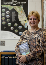 September 30, 2014 - Warm temperatures and a wet landscape increase soil’s ability to store carbon, which in turn helps mitigate greenhouse gas emissions, according to a new University of Florida study covering 45 years of data.
 Soil-stored carbon can slow the build-up of carbon-based gases in the atmosphere, a phenomenon believed to be a cause of global climate change. So it’s vital to preserve soil carbon, said Sabine Grunwald, a UF soil and water science professor who led the research.
![]()
![]()
![]()
![]()
![]()
![]()
![]()
![]()
![]()
![]()
![]()
The Florida Climate Institute (FCI) is a multi-disciplinary network of national and international research and public organizations, scientists, and individuals concerned with achieving a better understanding of climate variability and change.