Headline News Archive
 April 24, 2015 - Carbon, held in frozen permafrost soils for tens of thousands of years, is being released as Arctic regions of the Earth warm and is further fueling global climate change, according to a Florida State University researcher. Assistant Professor of Oceanography Robert Spencer writes in Geophysical Research Letters that single-cell organisms called microbes are rapidly devouring the ancient carbon being released from thawing permafrost soil and ultimately releasing it back into the atmosphere as carbon dioxide. Increased carbon dioxide levels, of course, cause the Earth to warm and accelerate thawing. "When you have a huge frozen store of carbon and it’s thawing, we have some big questions," said Dr. Spencer. "The primary question is when it thaws, what happens to it? Our research shows this ancient carbon is rapidly utilized by microbes and transferred to the atmosphere, leading to further warming in the region and therefore more thawing. So we get into a runaway effect."
FSU Press Release
Geographical Research Letters Article
 April 24, 2015 - The American Society of Civil Engineers (ASCE) selected Dr. Jayantha Obeysekera, Hydrologic & Environmental Systems Modeling, and Jose Sala, Emeritus Professor, Colorado State University, as recipients of the prestigious 2015 Norman Medal. They co-authored the paper, "Revisiting the Concepts of Return Period and Risk for Nonstationary Hydrologic Extreme Events."
 The Norman Medal was instituted and endowed in 1874 by George H. Norman and is the highest honor granted by the ASCE for a technical paper that "makes a definitive contribution to engineering." In selecting this work, the committee commended it as, " the presentation of a convincing concept and needed statistical techniques that advance knowledge of nonstationarity in hydrologic observations due to anthropogenic causes and natural processes." The award will be presented during the ASCE annual convention in New York City on October 13.
The paper was also published in the March 2014 issue of Journal of Hydrologic Engineering and selected as the year's "Best Paper" by the editors. This award will be presented at the World Environmental & Water Resources Congress in Texas in May.
 April 9, 2015 - As worldwide temperatures rise and the earth sees extreme weather conditions in both summer and winter, a team of researchers with the University of Florida and Kansas State University have found that that there is potential for insects – and possibly other animals – to acclimate and rapidly evolve in the face of this current climate change.
 “Organisms can deal with these stressful transitions from warm to cold by either acclimating – think about dogs putting on their winter coats – or by populations genetically evolving to deal with new stresses, a phenomenon known as rapid climate adaptation,” said Alison Gerken, a post-doctoral associate with UF’s Department of Molecular Genetics and Microbiology and the lead author of a new study, published this month in the journal Proceedings of the National Academy of Sciences.
UF Press Release
Proceedings of the National Academy of Sciences Article
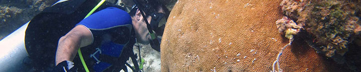
 April 2, 2015 - While research shows that nearly all coral reef locations in the Caribbean and Gulf of Mexico will experience bleaching by mid-century, a new study showing in detail when and where bleaching will occur shows great variety in the timing and location of these harmful effects.
 The new research published in Global Change Biology by NOAA scientists and colleagues provides the first fine-scale projections of coral bleaching, an important planning tool for managers.
“Our new local-scale projections will help resource managers better understand and plan for the effects of coral bleaching,” said lead author Ruben van Hooidonk, a coral and climate researcher with the Cooperative Institute for Marine and Atmospheric Studies at the University of Miami’s Rosenstiel School and NOAA’s Atlantic Oceanographic and Meteorological Laboratory.
NOAA Press Release
Global Change Biology Article
Image credit: NOAA
 April 1, 2015 - This series of papers, which include several FCI co-authors, describes results of a workshop where a regional hydrologic model was used to simulate the hydrology expected in the Florida Everglades in 2060 with climate changes including increased temperature, evapotranspiration, and sea level, and either an increase or decrease in rainfall. Ecologists with expertise in various areas of the ecosystem evaluated the hydrologic outputs, drew conclusions about potential ecosystem responses, and identified research needs where projections of response had high uncertainty. Resource managers participated in the workshop, and they present lessons learned regarding how the new information might be used to guide Everglades restoration in the context of climate change.
Access Special Issue: http://link.springer.com/journal/267/55/4/page/1
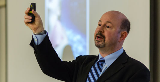 March 30, 2015 - What is the "false pause" in climate change data recently under debate? Distinguished Professor of Meteorology from Penn State Michael Mann presented his research to a rapt audience at a Geosciences Colloquium co-hosted by Center for Environmental Studies at Florida Atlantic University on February 27, 2015. Dr. Mann explained that the pause in the climate’s rise in temperature recently does not indicate a slowing in climate heating. Rather Mann and his team discovered an internal variability component--internal and forced low-frequency surface temperature variability at global and regional scales--that affects the climate directly and, when used in the climate models, does produce the false pause cooling we are experiencing now. It also indicates that the increase in temperature will begin soon and will be drastically hotter and more rapid than previously thought.
 Mann said recent climate cooling is not a slowdown of our climate warming rate. Instead the false pause is part of the internal variability of the climate neglected in past models. Neglecting internal variability has created a false sense of hope and failure to prevent harmful habits discouraging anthropogenic forcing. Typically used procedures for isolating natural internal oscillations like the Atlantic- and Pacific-based internal multidecadal variability (termed “AMO” and “PMO,” respectively) do fail when tested in a model-based framework where forced and internal variability are both known prior. The AMO signal is at the maximum shallow and the PMO is trending drastically downward.
The discovery, which led other researchers to similar conclusions, explained why the climate has been so cold this past winter compared to the last 5 years. It also explained how the natural, internal climate variability has a huge effect on predicting future climate and why the climate research community had not been in doubt of this component before. Many models incorporating the internal variability got the same results. Cooperation among the climate research community has led to great advances in a short time. Mann explained how the models run with thousands of parameters run by a single computer would have taken a year for produce result. Instead, a group of intelligent people collaborated for an important discovery.
The team reported their results in Science: http://www.sciencemag.org/content/347/6225/988.short
 March 30, 2015 - Under the direction of Dr. Colin Polsky, at the helm of Florida Atlantic University’s Center for Environmental Studies (CES) since August 2014, a number of workshops and opportunities for climate-related exchange and collaboration are on the horizon for FCI researchers and the wider community of stakeholders in Florida.
For the Spring, CES will host a workshop allowing representatives from FCI Universities and Southeast Florida Regional Climate Change Compact to meet and exchange ideas for research and collaboration. These two institutions have just started an exciting, formal working relationship to ensure that cutting-edge climate-related research meets the needs of some of the region’s leading stakeholders.
Following the success of their February 2015 USGS-FAU “Scientist Meet & Greet,” CES will host two more technical workshops, both relating to Everglades restoration. The “Precipitation downscaling, state-of-the-science” workshop will be held June 22-23, 2015, and the “Invasive species: scientific and management frontiers” workshop will take place in July or August. Both events will be convened in the Ft. Lauderdale area.
Continuing the popular series of Sea-Level Rise Summits pioneered by Emeritus CES Director Dr. Leonard Berry, CES plans for early 2016 “A Warming Arctic: Shared Futures from Alaska to Florida.” The meeting will convene leading researchers, decision-makers, and other interested stakeholders to discuss the state of sea-level rise science, and how public policy and private adaptation efforts can lessen the impacts everywhere.
And somewhere on the horizon, CES hopes to convene one more meeting based on the subject “Architecture/design responses to sea-level rise in the built environment.” The academic year 2015-2016 promises to be a year full productive conversation and scientific advancement.
For more information or to participate in CES initiatives, please visit www.ces.fau.edu and/or contact Mary Beth Hartman, Conference & Outreach Coordinator, Center for Environmental Studies, FAU via email to
During its 5th annual science fair earlier this week, the White House announced its $240 million pledge to further boost STEM initiatives around the country. Included was a description of the new University Innovation Freshman (#uifresh) campaign that will aim to improve retention rates among STEM students in their first year of college.
According to a report published by the President’s Council of Advisors on Science & Technology, 60 percent of students who arrive at college intending to major in STEM subjects will change their majors, often in their first year. The #uifresh campaign is run by the National Center for Engineering Pathways to Innovation, or Epicenter. The campaign, funded by the National Science Foundation and directed by Stanford University and VentureWell, aims to halt and reverse this trend and encourage more students to complete STEM degrees.
“The University of Florida is one of the largest producers of STEM degrees in the nation, and this initiative will help us become an even bigger contributor at the national level,” Provost Joe Glover said.
UF Press Release: http://news.ufl.edu/archive/2015/03/uf-one-of-10-schools-named-in-white-house-stem-initiative.html
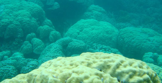 March 25, 2015 - Reef-building corals, already thought to be living near their upper thermal limits, are experiencing unprecedented declines as the world's oceans continue to warm. New evidence from scientists at Florida Institute of Technology shows there may be some climate refuges where corals will survive in the future. The study appears in the March issue of Global Change Biology.
 Ph.D. student Chris Cacciapaglia and his advisor, Robert van Woesik, hypothesized that not all regions of the oceans are warming at the same rate. "The idea was to identify regions that will experience little temperature change by the year 2100 --refuges where coral survival is most likely," Cacciapaglia said. Although their models show significant loss of corals as the oceans warm, they also highlight 12 areas -- five in the Indian Ocean and seven in the Pacific -- where corals are likely to survive at least until 2100. "These refuges should be essential for coral survival into the future, and these locations deserve protection," said van Woesik. Van Woesik emphasized that local marine protected areas are not the only viable management option. The new study points to global sanctuaries as a more comprehensive management strategy.
FIT Press Release: http://newsroom.fit.edu/2015/03/25/florida-tech-study-locates-refuges-for-corals-in-a-changing-climate/
Global Change Biology Article: http://dx.doi.org/10.1111/gcb.12851
March 15, 2015 - In response to several inquiries about the FCI’s response to the allegations about Governor Scott’s unwritten rules regarding the use of the words “climate change” and “global warming” by state agencies in communications, a statement was provided to news agencies and local media. FCI @ UF Director James Jones provided the statement found here:
http://floridaclimateinstitute.org/images/document_library/media_releases/201503-fci-statement.pdf
http://floridaclimateinstitute.org/images/document_library/media_releases/201503-fci-statement.pdf
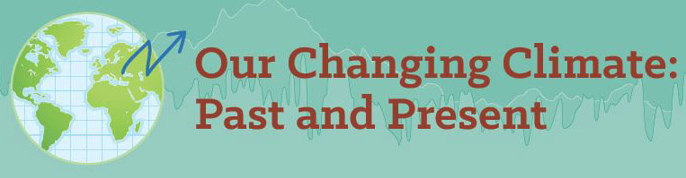 March 11, 2015 - Visitors can discover 70 million years of climate change on Earth in a new exhibit now open at the Florida Museum of Natural History in Gainesville. The “Our Changing Climate: Past and Present” exhibit uses large-format graphs showing major historic events to present the story of Earth’s changing climate over geologic time. The exhibit also highlights how Earth’s climate fluctuates and what global trends are affecting life today.
UF Press Release: http://news.ufl.edu/archive/2015/03/florida-museum-opens-new-exhibit-detailing-world-climate-change.html
Museum Website: http://www.flmnh.ufl.edu/exhibits/limited-time-only/changing-climate/
 March 2, 2015 - The FCI at the University of Florida hosted 2 international events to explore the impacts of climate on global agriculture. The first event brought together pest and diseases specialists from 10 countries for 2.5 days of team building and solution-oriented research collaborations. See more at http://conference.ifas.ufl.edu/pest/index.html.
The second event was the AgMIP 5th Global Workshop which brought researchers in agronomy, economics, climate, and data optimization together toward solutions for food security issues facing the growing population globally. See more at http://www.agmip.org/
 March 2, 2015 -“Changing the Atmosphere: Anthropology and Climate Change” is the final report of the American Anthropological Association’s (AAA) Global Climate Change Task Force. The report’s objectives are: to provide a guiding document on anthropology and climate change in its broadest sense, including anthropology’s contributions to, and concerns about, climate change and climate change policy and discourse; to provide commentary on interdisciplinary research and climate change policy and discourse; to provide commentary on interdisciplinary research and relationships; and to identify research frontiers for anthropology with respect to climate change. The audiences for the report are the AAA Executive Board and the anthropological discipline; interdisciplinary colleagues, organizations, and institutions; and ultimately and ideally, policymakers, the media, and the general public. This Executive Summary provides readers with a short description of the highlights and sections of the Report, including the Conclusions and Recommendations (both more fully developed over the course of the report and specifically in Sections 7.0 and 8.0, respectively).
The report has the following foci in its approach: (a) human causes and contributions to climate change and the problematizing of human drivers; (b) the identification of lessons learned about human adaptation, survival and change over long time periods; (c) the critique of central concepts used in climate policy on global, state and local levels (adaptation, vulnerability and resilience); (d) the importance of the local and community engagement; and (e) interdisciplinary strengths and opportunities, and research priorities for the future for anthropology and global environmental change.
Download Report: http://www.aaanet.org/cmtes/commissions/upload/GCCTF-Changing-the-Atmosphere.pdf
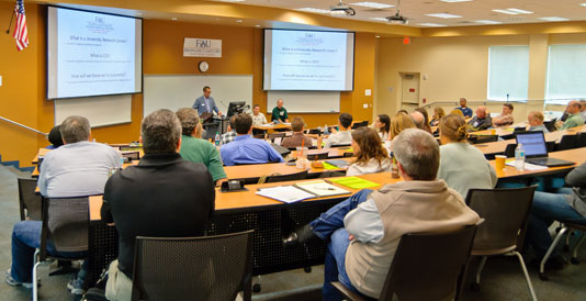
 February 26, 2015 - Collaboration between US Geological Service (USGS) and Florida Atlantic University (FAU) scientists will continue to flourish and hopefully increase, thanks to a jointly-hosted event held on February 6, 2015 at the Florida Center for Environmental Studies (CES) on the FAU Davie Campus. The trans-disciplinary meeting aimed to strengthen partnerships between the two groups, which since 2014 have neighboring office space in the Davie West Building. By sharing research interests and facilitating conversations, both teams hope to develop new linkages among participants and strengthen existing ones.
After opening remarks, each of the 30 researchers had two minutes to present two slides highlighting their individual research backgrounds and interests. Experts presented their work in fields such as biology, civil engineering and geosciences. Other colleagues showcased the answers they’re seeking in hydrology, carbon cycling, ecological modeling and human dimensions. Subsequent break-out groups and informal networking provided opportunities to identify common goals and needs and to make connections.
Dr. Colin Polsky, Director of CES, said, “The meeting exemplified the kind of interaction CES is known for—interaction between scientists in diverse fields with the chance to advance Sustainability Science.”
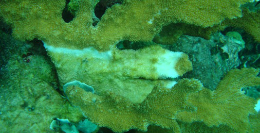 February 23, 2015 - Over the last four decades, the iconic elkhorn and staghorn corals that dominated Caribbean reefs for millions of years have all but disappeared. According to a new study from Florida Institute of Technology, ocean warming has played a significant role in this dramatic decline. The results of the study also suggest that limiting the rate of ocean warming, which would require curbing greenhouse gas emissions, could support the recovery of these critical reef-building corals.
 White-band disease is a widespread coral disease that affects elkhorn and staghorn corals, and this disease has been plaguing these corals for decades. Florida Tech Ph.D. student Carly Randall and her faculty advisor, Robert van Woesik, studied the relationship between ocean temperatures and white-band disease and reported their findings in the February issue of Nature Climate Change. The study was posted this morning on the journal’s website at http://dx.doi.org/10.1038/nclimate2530.
Read Full FIT Press Release: http://newsroom.fit.edu/2015/02/22/new-florida-tech-study-links-coral-disease-to-a-warming-atlantic/
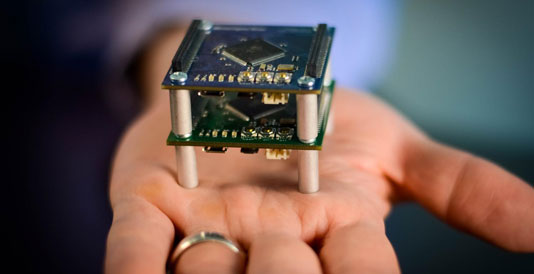 February 18, 2015 - Small wireless computing devices, ranging from the size of a matchbox to the size of a dime are going to change the way Florida monitors its water quality, sea level rise, hurricanes, agriculture, aquaculture, and even its aging senior population. The types of sensing devices developed by computer scientist Jason Hallstrom, Ph.D., who recently joined Florida Atlantic University, can collect information about the surrounding environment and transmit that information to cloud-based computing systems that store, analyze and present that information to educators, researchers and decision-makers. Deployable at massive scales, the technology represents a paradigm shift in how our world is observed and managed.
Read Full FAU Press Release: http://www.ceecs.fau.edu/news/1502_hallstrom.php
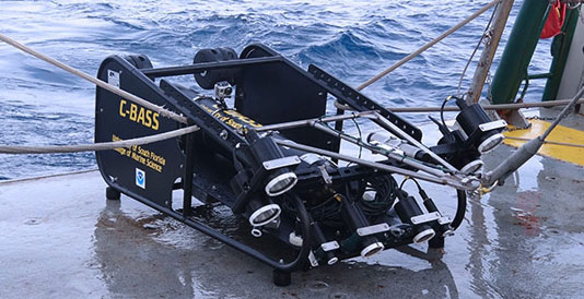 February 4, 2015 - The project will deploy a towed camera system called C-BASS (Camera-Based Survey Assessment System). Developed at the USF Center for Marine Technology, C-BASS will be deployed to determine the density, species composition and size structure of fishes using the various habitats.
 "This set of studies will use state-of-the-art ocean imaging technologies to better understand and protect habitats off the west coast of Florida,” said College of Marine Science Dean Jackie Dixon."
- Read the full article at WUSF News
- Read the full article at Tampa Bay Newswire
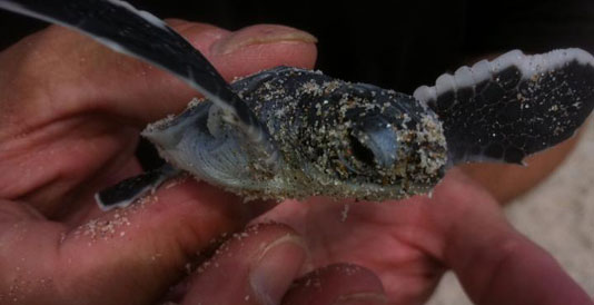 January 21, 2015 - A new University of Central Florida study is sounding the alarm about climate change and its potential impact on more than 30 years of conservation efforts to keep sea turtles around for the next generation.
 Climate change is causing sea-level rise, and how coastal communities react to that rise could have dire consequences for sea turtles and other wildlife that rely on an unobstructed beach for survival. That's the conclusion of a University of Central Florida study recently published in Chelonian Conservation and Biology.
Llewellyn Ehrhart, a biology professor emeritus at UCF, began studying sea turtles in what later became the Archie Carr National Wildlife Refuge in southern Brevard County 31 years ago. By documenting the number of turtles laying eggs, the number of eggs that hatch and how many turtles make it to the water, he was able to demonstrate what is documented fact today: The 13-mile stretch of beach in southern Brevard is one of the most important nesting habitats for green and loggerhead turtles in the western hemisphere.
UCF Press Release: http://www.eurekalert.org/pub_releases/2015-01/uocf-cct012115.php
Chelonian Conservation and Biology Article: http://dx.doi.org/10.2744/CCB-1100.1
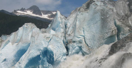 January 20, 2015 - As the Earth warms and glaciers all over the world begin to melt, researchers and public policy experts have focused largely on how all of that extra water will contribute to sea level rise. But another impact lurking in that inevitable scenario is carbon. More specifically, what happens to all of the organic carbon found in those glaciers when they melt?
 That’s the focus of a new paper by a research team that includes Florida State University assistant professor Robert Spencer. The study, published in Nature Geoscience, is the first global estimate by scientists at what happens when major ice sheets break down.
“This is the first attempt to figure out how much organic carbon is in glaciers and how much will be released when they melt,” Spencer said. “It could change the whole food web. We do not know how different ecological systems will react to a new influx of carbon.”
FSU Press Release: http://news.fsu.edu/Top-Stories/Study-Melting-glaciers-have-big-carbon-impact
Nature Geoscience Article: http://dx.doi.org/10.1038/ngeo2331
![]()
![]()
![]()
![]()
![]()
![]()
![]()
![]()
![]()
![]()
![]()
The Florida Climate Institute (FCI) is a multi-disciplinary network of national and international research and public organizations, scientists, and individuals concerned with achieving a better understanding of climate variability and change.