 High-resolution land cover data is now available through NOAA’s Digital Coast. This data provides communities with the foundational data needed to assess coastal resources, analyze land use, prepare for disaster risks, and adapt to a changing climate.
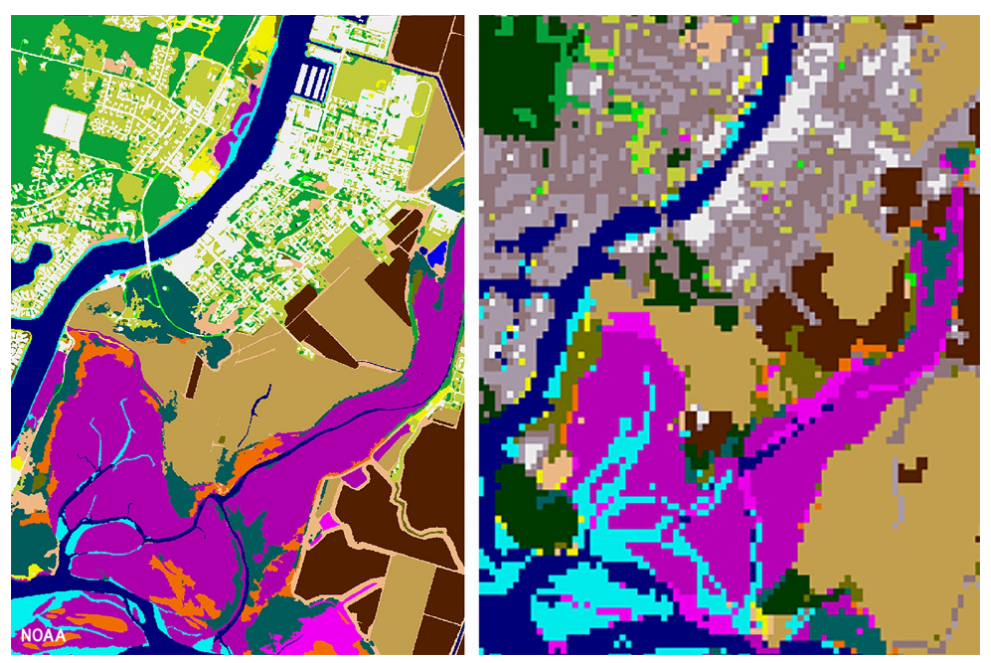
Land cover is a foundational data set that provides valuable information for a range of applications, including natural resource management, land use planning, disaster risk reduction, and climate adaptation. By comparing one year to another, people also use the information to document how the landscape has changed over time.
NOAA, in conjunction with several partners, released a high-resolution version of this data product, moving from 30-meter resolution to 1-meter.