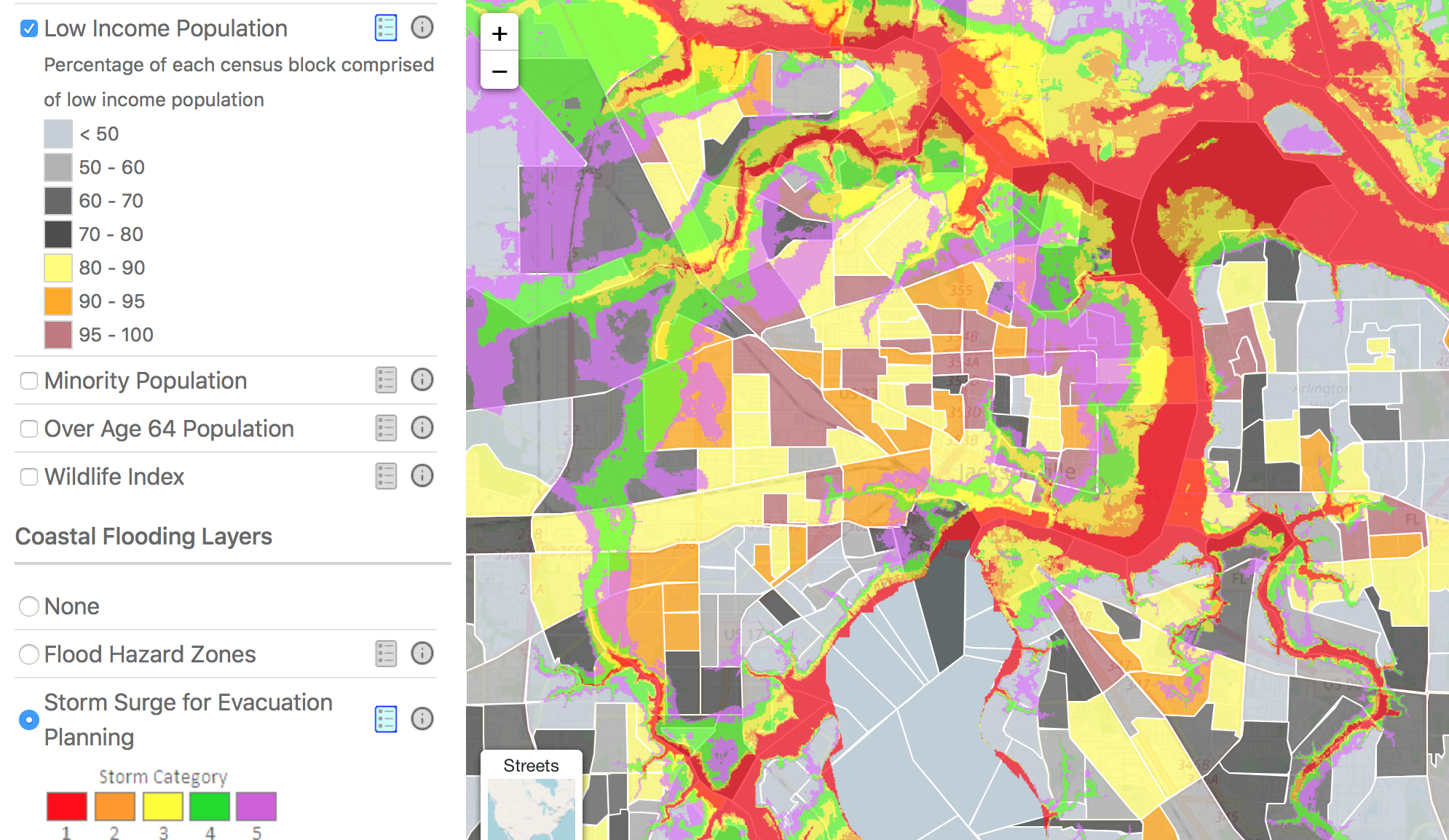
 In Northeast Florida, a new resource is educating local stakeholders about coastal hazards and vulnerabilities. The "Regional Resilience Exposure Tool," licensed by the Northeast Florida Regional Council (NEFRC) and developed by Taylor Engineering, allows local residents, business owners, and government actors to determine if resources are exposed to specific coastal hazards. In addition to coastal flood layers, the tool features other data layers relating to demographic and social measures that can be visualized in a variety of ways.
The Regional Resilience Exposure Tool (R2ET) is intended to function as a base-line resource for citizens, businesses, and governmental actors to kickstart conversations about sea level rise and emergency preparedness. Utilizing this tool, as well as other community engagement resources offered by the Northeast Florida Regional Council, local communities can have better-informed conversations about building a resilient future. The tool has been utilized to support data and analysis sections of local government comprehensive plans, and is currently being used to better inform the work of the Jacksonville City Council, Special Committee on Resiliency.
To check the exposure of a local community asset in Northeast Florida, visit the official webpage for the Regional Resilience Exposure Tool.